Powell River Blueway continues to expand
Published 7:25 pm Tuesday, January 21, 2020
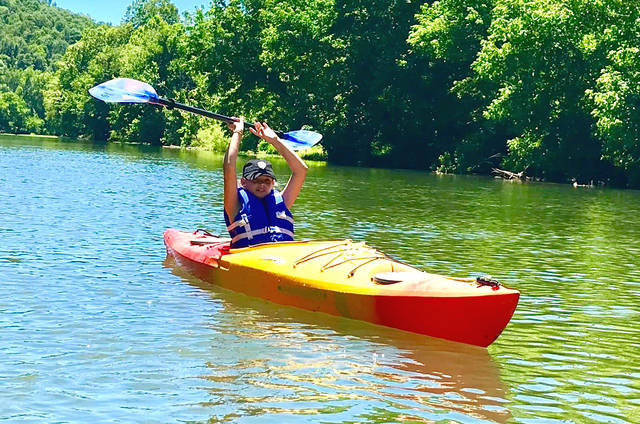
Photo by Steve Roark
The Powell River Blueway provides access to the beauty and enjoyment of the river.
|
Getting your Trinity Audio player ready...
|
What is a Blueway? It is a water path or trail that is developed with launch points, camping locations, parking and points of interest for canoeists and kayakers. In 2016, as interest in Powell River access was growing in Claiborne County, the Claiborne County Tourism Commission began the Powell River Blueway Trail project.
The focus of the Powell River Blueway Trail is to improve public access to the river for fishing and paddling and improve the use of and love for the Powell River. As a means of putting non-motorized boats into the water, the Powell River Blueways Trail provides the public with various public put-in and take-out points.
These access points are open to the public and these properties do not create any restraints on adjoining properties, nor does it give the public the right to access properties along the river that are private and outside our management.
Through several grants the Blueway Trail underwent several improvements in 2018, including three new access sites. A site at the U.S. 25E bridge, located just south of Harrogate, was improved in late spring and now has an access road and parking.
Lock Lane located off Cedar Grove Road was completed in late summer and also has parking and utilizes an old river ford to put boats in the water. Mulberry Creek in Hancock County is a pre-existing access site maintained by the Tennessee Wildlife Resources Agency but had flood damage.
This site was re-graded to provide safer public access. This brings the total number of Powell River access sites to 12, stretching from McDowell’s Shoals near Four Mile Creek in Hancock County downstream to Earl’s Hollow in Claiborne County.
Other improvements carried out in 2018 include constructing information kiosks at Blueway parking areas that provide river location information and descriptions of some of the unique natural history of Powell River. In addition, these kiosks provide visitors with a map of the river and location of each of the public access points. Road access to these sites was also improved with the installation of directional road signs.
Future plans for the Powell River Blueway are to continue establishing additional access points, including one at Brooks Bridge on Cedar Fork Road and to assist organizations in Lee County in establishing access points further upriver.
Additional information on the Powell River Blueway, including maps of site locations, can be found at the Claiborne County Chamber office or at their website www.powellriverblueway.org. The Powell River Tourism Committee will be hosting the annual Powell River Kayak and Canoe Regatta on May 2. This 12-mile event is a great way to see the beauty of the river while supporting the Blueway Project. Information on the regatta is also on the website.